


Cartographic archives
Barri Vell Campus library
Plaça Ferrater Mora, 1
17004 Girona
Monday to Friday from 8 am to 9 pm.
- For specific consultations in the map library:
Monday to Friday 9 am to 3 pm.
Or send an email to: cartoteca@udg.edu
Map Library office: 1st floor of the Barri Vell Campus library
Map Library classroom with 38 places: 1st floor of the Barri Vell Campus library
IT classroom with the specific SIG programme: 1st floor of the Barri Vell Campus library
Paper maps and aerial photographs
26,590 map sheets on paper, all from the 20th century The maps cover the whole world, but a large proportion of them refer to Spain, and especially Catalonia. Girona province is covered in its entirety.
You can consult the map library map archive in the UdG Library Catalogue.
Most of the 26,590 map sheets in the map library (figures from July 2018) form part of map series, but there are also some single-sheet maps of mainly physical and human aspects.
- Map series:
These are maps comprised of many sheets which all together cover the entire territory the map refers to. Two groups can be identified, in line with sheet portioning theory:
Grid map series: each sheet corresponds to a square on a grid that portions the mapped territory in an imaginary way. These maps can be found in a single bibliographic register in the UdG Library Catalogue. The sheets that make up the map are specified in the Description field, and in the Access field there is a link to the image of the map showing the sheets available.
For example:

Territorial map series: each map shows part of a territory that is organised in some way, be it geographically or administratively (counties, provinces). You will find a bibliographic register for each sheet and the title of the series in the Collection field.
For example:
- Single sheet maps:
Single-sheet maps: these are maps that map the territory in a single sheet or in very few sheets (map in sections). They are normally themed (geological, tourist, and so on).
For example:

Aerial photographs
The UdG Map Library currently includes 6,417 aerial photographs from different years, which mainly cover the Girona counties and neighbouring ones.
A) Army Geographical Service flight from 1956-1957, known as American flight, on a scale of approximately 1:30 000: image showing available sheets
b) National Geographical Institute flight from the 1970s, on a scale of approximately 1:30 000:and some photograms on a scale of 1:25 000: image showing available sheets
c) Cartographic Institute of Catalonia flight, around 1990, on a scale of approximately 1:22 000: image showing available sheets
d) Cartographic Institute of Catalonia flight between 2000-2004, on a scale of approximately 1:22 000 and in colour: image showing available sheets
Overlaid images are produced and updated of some of the main cartographic series .
Map series of the Spanish State for which we have images on the website:
Military map of Spain 1:800 000: image showing sheets available at the UdG
Military map of Spain 1:400 000: image showing sheets available at the UdG
Military map of Spain 1:200 000: image showing sheets available at the UdG
Spatial orthoimage 1:500 000: [Spain]: image showing sheets available at the UdG
Spatial orthoimage 1:100 000: [Spain]: image showing sheets available at the UdG
Map series of Catalonia for which we have images on the website:
Topographic map of Spain, M781 series, 1:50 000 (“American” edition of the Army Map Service): image showing sheets available at the UdG
Spanish military cartography [Scale 1:25 000]: master plan: image showing sheets available at the UdG
National topographic map of Spain 1:25 000 [version 1]: image showing sheets available at the UdG
National topographic map of Spain 1:25 000 [version 2]: image showing sheets available at the UdG
Topographic map of Catalonia 1:10 000: image showing sheets available at the UdG
Topographic map of Catalonia 1: 5 000: image showing sheets available at the UdG
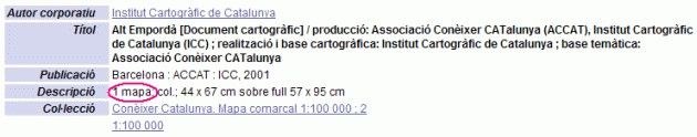
Orthoimage of Catalonia 1: 100 000: image showing sheets available at the UdG
Map of Catalonia from a satellite image 1:100 000: image showing sheets available at the UdG
Orthophotomap of Catalonia 01:50 000: image showing sheets available at the UdG
Orthophotomap of Catalonia 01:25 000 [version 1.0]: image showing sheets available at the UdG
Orthophotomap of Catalonia 1:25 000 [version 2.0]: image showing sheets available at the UdG
Orthophotomap of Catalonia 1:25 000 [version 5.0]: image showing sheets available at the UdG
Orthophotomap of Catalonia 1:25 000 [version 6.0]: image showing sheets available at the UdG
Orthophotomap of Catalonia 1:25 000 (infrared colour): image showing sheets available at the UdG
Orthophotomap of Catalonia 1:5 000 [version 1]: image showing sheets available at the UdG
Orthophotomap of Catalonia 1:5 000 [version 2]: image showing sheets available at the UdG
Orthophotomap of Catalonia 1:5 000, version 3.0 and version 4.0: image showing sheets available at the UdG
Thematic map series for which we have images on the website:
Map series of the vegetation in Spain 1:400 000 and report: image showing sheets available at the UdG
Map of the forests of Spain: Scale 1:200.000: image showing sheets available at the UdG
Geotechnical map of Spain 1:200 000: image showing sheets available at the UdG
Map of industrial minerals of Spain 1:200 000: image showing sheets available at the UdG
Geological map of Catalonia 01:25 000: image showing sheets available at the UdG
Map of crops and exploitations [Spain] Scale 1:50 000: image showing sheets available at the UdG
Map of the urban planning and land use of Catalonia 1:50 000: image showing sheets available at the UdG: 1st edition
Online atlases and maps
Historical cartography
- Euratlas: history and geography of Europe
- Atlas historique: l'histoire du monde contemporain (de 1815 à nos jours) en cartes
- TimeMaps: atlas of world history
- Cartographic archives of the IGN: Spain, XVI-XIX centuries
- Cartocat
- David Rumsey Map Collection
- Old Maps Online
- Gallica
- Collection of Maps, Plans and Drawings from the Simancas General Archive
Official cartography managers’ centre
- National Geographic Information Centre (CNIG)
- National Geographic Institute (IGN)
- Army Geographical Centre
- Cartographic and Geological Institute of Catalonia (ICGC)
- Girona City Council. UMAT (Municipal Territorial Analysis Unit) Observatory
Geography professionals
- Spanish Geographers Association (AGE)
- Spanish Geographic Information Systems Association (AESIG)
- Catalan Geography Society (IEC)
- SIGTE
- IBERCARTO
- Department of Geography UdG
Statistical data suppliers
- The World Factbook: Statistical Atlas of the CIA
- Barcelona Provincial Council: HERMES, Local Socio-economic Information System
- Girona Provincial Council: XIFRA, Local Socio-economic Information System
- Catalonia. Statistical Institute of Catalonia: general index (IDESCAT)
- INE - National Statistics Institute
- EUROSTAT: Statistical Office of the European Communities
- Tarragona Provincial Council: MERCURL, Local Socio-economic Information System
- To help any interested user to consult and copy cartographic material.
- To advise on searching for cartographic or bibliographic material about a subject or a place. Hard copy and digital supports.
- To advise on bibliographies and citations concerning students’ work.
- To encourage the use of cartography as a source of scientific information.
- To provide support for teaching staff when searching for and using cartographic material for their classes and in their research
- To disseminate the maps we have at the map library through the “Map of the Month” activity.
- To cede material and take part in any related University activity, and collaborate with institutions and bodies related to cartography.